

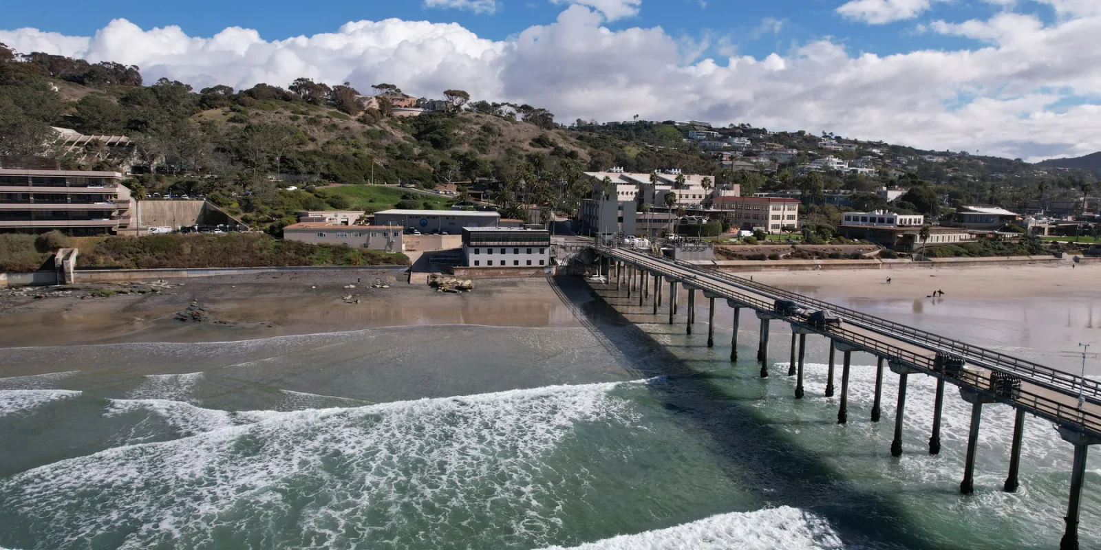
San Diego’s coastline rewards sequence more than accumulation. La Jolla, Pacific Beach, Mission Beach, Ocean Beach, Sunset Cliffs, Coronado, the harbor, and the bay are not interchangeable stops on one continuous boardwalk. They face different water, sit inside different street networks, and ask for different kinds of attention. A useful coastal day begins by choosing one geographic arc, then leaving enough room for marine layer, traffic, transit, surf, tides, closures, and the simple fact that a good view can hold you longer than expected.
The route below moves from La Jolla toward Ocean Beach. It is not a timed itinerary and does not assume that every path, pier, beach access point, or business is open. Use it as a planning framework, then confirm current conditions with the City of San Diego, California State Parks, the National Weather Service, lifeguards, transit operators, and each venue you intend to enter.
Read the coast as a series of conditions
Start by looking at a map without placing pins. Notice where bluffs interrupt the beach, where a pier projects into the water, where a cove faces a different direction, and where streets or river channels change the connection. The coastline is close enough to feel continuous, but the transitions can consume more of the day than the distance suggests.
Marine layer can soften the morning and clear unevenly. Wind can rise later. Surf and tide can narrow a beach or make a rocky edge inappropriate. Parking supply, transit frequency, accessibility, and construction can also change the most sensible order. Build a plan with one primary coastal setting, one optional middle chapter, and one late-day place. Anything beyond that is a bonus rather than a promise.
Before you choose the first stop
- Check official conditions. Look for beach, bluff, trail, surf, weather, water-quality, and closure information from the responsible agency.
- Choose the transition. Decide whether you will drive, use transit and short walks, cycle on an appropriate route, or stay within one district.
- Save the exact arrival and return points.
- Confirm the final walking surface and accessibility needs.
- Protect the flexible part. Keep at least one chapter optional so a long lunch, museum visit, wildlife observation, or difficult connection does not make the rest of the day feel late.
- Carry the basics. Water, sun protection, a warm layer, secure footwear, and a charged phone are useful even when the forecast looks simple.
- Know your turn-around point. Bluffs, wet rock, rising tide, heat, fatigue, and darkness are reasons to choose a shorter route.
Morning: give La Jolla one clear purpose
La Jolla can support several very different mornings. You might focus on the cove and nearby shoreline, a broad pier view, an inland museum or gallery, a walk through the village, or a coastal trail farther north. Trying to combine all of those before lunch turns a place into logistics. Choose one and let the others remain visible possibilities.
A shoreline morning should begin with safe public access and current conditions. Wildlife is not a prop. Keep distance, obey closures and barriers, never block an animal’s route, and follow posted guidance. Cliffs and wet rock require the same restraint. A viewpoint is successful even when you do not descend to the water.
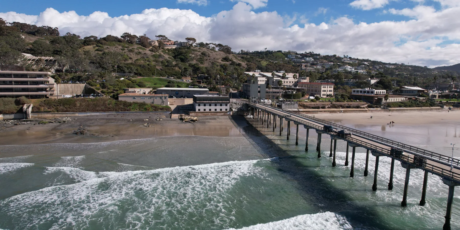
For a village-focused morning, treat the public realm as the subject. Look at how streets meet the edge, where shade appears, and how steep grades affect a walking route. If you plan to enter a museum, gallery, restaurant, or shop, verify its current opening information directly. Build in a simple alternative that does not depend on a reservation.

San Diego Bay Jet Boat Ride
A boat ride on San Diego Bay is lovely, but an exhilarating ride on a dual-engine jet boat is an experience to remem...

2-Hour San Diego Pier Fishing Experience
Enjoy a two-hour guided tour of San Diego catch or release fishing from the Pacific Ocean. Our guides are friendly...

Top Rated San Diego Sunset Sail Classic Yacht 6 Guests
Skip the crowded tour boats. Liberty carries just six guests and that changes everything. Sail San Diego Bay aboard...
Choose one middle chapter
The middle of the day is where ambitious coast plans often break. A direct-looking line on the map can involve slow traffic, a transfer, a search for parking, or a long walk in exposed conditions. One strong middle chapter is enough. The options below are planning types, not a claim about current access.
| Middle chapter | What it adds | What to verify | When to shorten it |
|---|---|---|---|
| Beach and boardwalk | A flatter public edge, people watching, and an easy place to pause | Transit, parking, beach advisories, path rules, and accessibility | When heat, crowds, wind, or mobility needs make a long exposed segment uncomfortable |
| Bay or harbor edge | Protected-water scale, vessels, parks, and a different relationship to downtown | Event impacts, path closures, ferry or transit details, and operating hours | When the connection would displace the late-day coast rather than complement it |
| Neighborhood meal | Shade, a slower pace, and local street context away from the sand | Current hours, reservations, dietary information, and accessibility | When a long wait would force a rushed final chapter |
| Single cultural stop | History, art, architecture, or interpretation that gives the geography meaning | Admission, hours, bag rules, photography policy, and time needed inside | When you have less than the visit deserves |
If you choose a beach-and-boardwalk segment, decide whether the goal is movement or rest. Walking the entire visible edge is not automatically better than choosing a comfortable section and observing it well. Bicycles, e-bikes, skates, pedestrians, service vehicles, and other users can share space under changing local rules. Follow posted signs and use a route appropriate to your skill and equipment.
If you choose a meal, resist making “local” a test that a restaurant has to pass for you. Read the menu, business information, and current reservation guidance. Be patient with staff. A neighborhood is not more authentic because it is unfamiliar to a visitor, and popularity does not erase the work of the people who operate there.
Transition south without treating the drive as blank time
The move toward Ocean Beach crosses a different urban field. Depending on the route and mode, you may encounter Mission Bay, river crossings, beach communities, commercial corridors, and airport or harbor movement. Do not add stops simply because they appear nearby on a screen. Watch the time and preserve the final place.
Drivers should plan for legal parking before they arrive and never assume that a curb seen in an older photograph remains available. Transit riders should check the current trip in the operator’s official planner, including the final return. Cyclists should use current route guidance and avoid improvising onto infrastructure that feels unsafe. A ride-hail trip still needs a lawful and considerate pickup point.
Late day: Ocean Beach as a neighborhood and an edge
Ocean Beach is more useful as a final chapter when you allow both the street and the water to register. Start inland enough to understand where shops, food, residences, and public movement meet the beach. Then approach the edge through a safe public route. A pier, bluff, or beach may be affected by repairs, weather, surf, erosion, or temporary closure, so build the evening around the place rather than one structure.
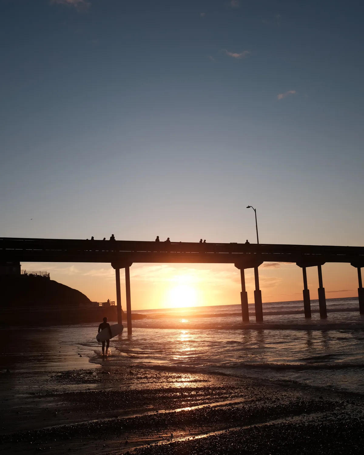
Sunset is not a reservation. Clouds, marine layer, season, and horizon conditions change the light, and the most memorable part may happen before or after the sun is visible. Arrive with enough time to choose a safe place without rushing. Stay back from unstable edges and never enter water beyond your ability or contrary to warnings.
Have a return plan before darkness. Confirm the current transit trip, identify a lawful pickup area, or note where your vehicle is parked. Keep pathways clear and lower your voice near homes. A coastal neighborhood remains a neighborhood after the view is over.
How to adjust for weather and marine layer
San Diego weather is not one permanent postcard. Morning low cloud can make a wide coastal view subtle and textured. Inland sun can feel stronger than the beach. Wind can turn an exposed pause into a short one. A warm layer, water, and a willingness to reverse the order can preserve the day without pretending conditions are a disappointment.
Do not use a general city forecast as the only source for water or cliff decisions. Marine forecasts, surf information, beach advisories, lifeguard guidance, posted closure notices, and land-manager alerts answer different questions. If sources disagree, choose the more conservative plan or stay in the public street and park network.

USS Midway Museum Admission: Valid Any Date
Experience life at sea without leaving port by visiting the USS Midway Museum, San Diego's number 1 rated visitor at...

San Diego Harbor Speed Boat Adventure
Rev up your excitement with a one-of-a-kind San Diego Speed Boat Adventure! Captain your own speed boat on a guided...

San Diego Seal Tour
Hop aboard San Diego’s only amphibious Sea and Land Adventure for an unforgettable 1 hour and 45 minute tour that...
Accessibility and comfort are route decisions
A route described as short can still include steep grades, sand, uneven surfaces, narrow paths, missing curb access, or long distances between restrooms and shade. Check official accessibility information for each public space and contact a venue directly about specific needs. Beach access programs, mats, chairs, elevators, parking, and restroom availability can change by location and condition.
For a lower-exertion version, select one paved viewpoint, one seated meal or indoor cultural stop, and one late-day public edge with a known return. For families, the limiting factor may be shade, restrooms, nap timing, or safe separation from traffic and water. For older travelers, a stable viewpoint can be more rewarding than a long exposed walk. The right route is the one the group can enjoy without borrowing energy from the next day.
Pack for transitions, not an idealized beach day
- Carry refillable water and drink before you feel depleted.
- Use sun protection appropriate to the day, even under light cloud.
- Bring a warm layer that can handle wind after sunset.
- Wear shoes suitable for the surfaces you actually plan to use.
- Keep a compact bag that meets any venue rules on the route.
- Download or save essential directions while you have a reliable connection.
- Carry necessary medication and accessibility equipment, but avoid leaving valuables visible in a vehicle.
- Use a small light after dusk without shining it at wildlife, homes, or other people.
Wildlife and habitat change the visitor’s role
Seals, sea lions, birds, tide-pool life, coastal plants, and other wildlife need distance and an unobstructed route. Follow barriers and current official guidance. Do not approach for a photograph, feed wildlife, touch animals, collect living material, or place yourself between an animal and the water. Dogs and food can create additional pressure, so observe posted rules.
Stay on designated trails in sensitive bluff and reserve environments. Erosion can make a familiar-looking edge unstable. Pack out what you bring, avoid loud playback, and treat tide pools as habitat rather than a display. A respectful visit often produces fewer dramatic photographs and a better outcome for the place.
Three ways to scale the day
A compact coast day
Choose either La Jolla or Ocean Beach as the main setting, add one meal or indoor stop nearby, and stay within that district. This is the strongest choice when conditions are uncertain, the group moves at different speeds, or you want time to observe rather than transfer.
A connected two-place day
Spend the morning in one La Jolla setting, make a deliberate southbound transition, and end in Ocean Beach. Skip the middle chapter. This preserves contrast while limiting the number of arrival and departure decisions.
A full coast-and-city day
Use La Jolla as the morning anchor, choose one short bay, beach, meal, or cultural chapter in the middle, and reserve Ocean Beach for late day. This version requires the most current transport research and the strongest willingness to drop the optional stop.
Use primary sources at the decision point
A durable guide cannot replace live authority. Before departure, review the responsible public agency for closures and rules, the National Weather Service for weather, relevant marine and beach sources for water conditions, the transit operator for the current trip, and each business or venue for hours and reservations. If you are considering a guided activity, review the provider’s current description, inclusions, restrictions, meeting information, cancellation terms, and accessibility details before booking.
Keep screenshots or saved links for the details that matter, but refresh them close to the visit. A cached search result, social caption, or old article is not a current operating notice.
End with enough room to notice the change
The value of moving from La Jolla to Ocean Beach is not that you have collected two famous names. It is that the coastline changes its relationship to research institutions, villages, beaches, river and bay systems, commercial streets, neighborhoods, piers, and sunset. When the route has breathing room, those changes become legible.
Plan one coast, one transition, and one final edge. Let current conditions edit the rest. The day will feel fuller because it was allowed to stay coherent.

San Diego Hop On Hop Off Trolley Tour
Discover San Diego at your leisure with a unique tour around "America's Finest City". Create your own itinerary to s...

2-Hour Private Sailing Experience in San Diego Bay
Our unique sail displays a peace sign because that is exactly what we share with our customers, peace. Peace is not...

Private Sailing Charter on San Diego Bay
San Diego Bay is one of the most beautiful bodies of water on the West Coast of the United States. Why not enjoy thi...
Still comparing Practical Coastal Day La Jolla Ocean Beach?
Ask for tour ideas, hotel suggestions, or a simple trip plan that combines both.